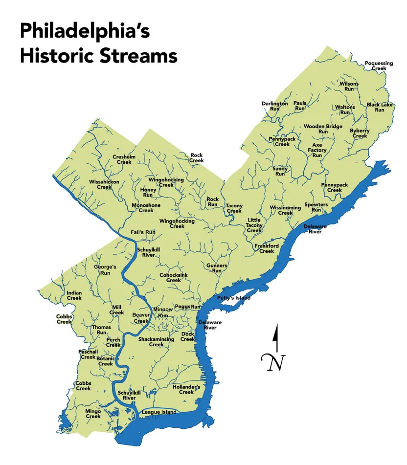
In my day job I've mapped buried streams to give an indication of areas that are most likely to flood in major storms. It turns out that buried streams in older urban centers is common everywhere. Hidden Hydrology is a great resource for exploring disappeared waterways throughout the country. I stumbled across their extensive PhillyH2O page. Here are some maps, from the extensive Water History PHL site.
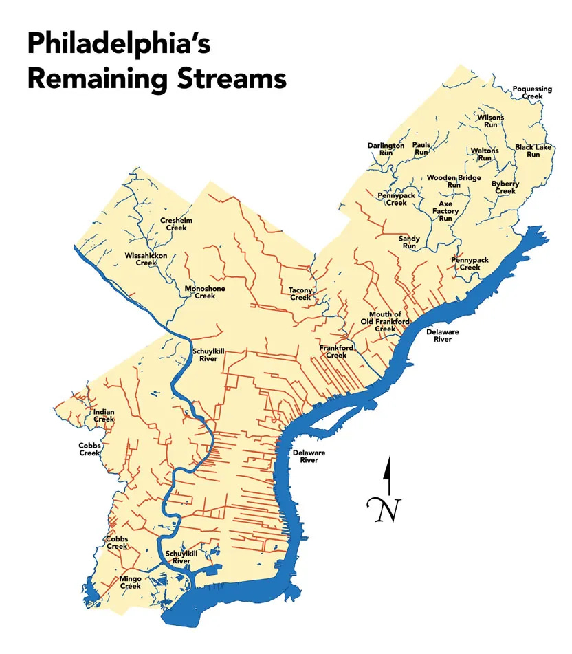
The map below shows just how few of the original streams (in blue) remain and shows the sewers that have replaced these streams in red.
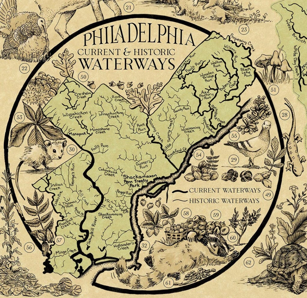
An inset from the Lenapehoking Map, mentioned last week also does an artistic job of showing these same waterways.
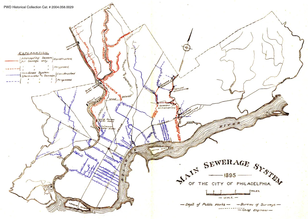
Here is an 1895 map from the Water Department showing the proposed and existing sewers and how they head for and follow streams to take advantage of the gravity flow.
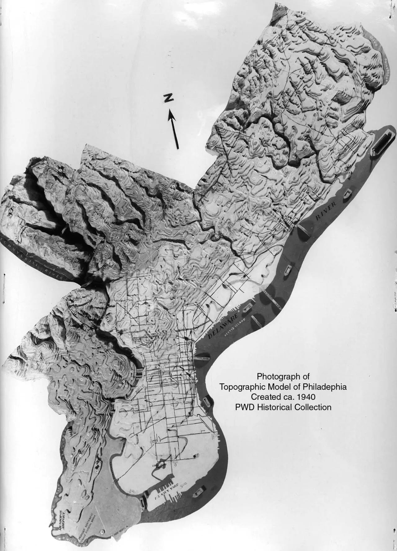
Here is an exaggerated topographic model of the city
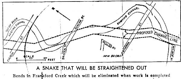
Finally a diagram of Frankford Creek. The "A Snake That Will Be Straightened Out" says everything about the attitude of conquering nature that was prevalent at the time.
There's plenty more to read about Philadelphia's water system here and other cities here.


Axe Factory Run. Best name I’ve seen